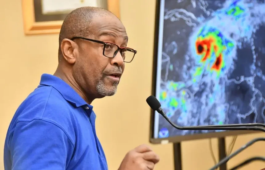
While Jamaica is no stranger to tropical storms, principal director at the Meteorological Service of Jamaica (Met Service) Evan Thompson has warned that the looming Hurricane Melissa could hit the island with greater effect than Jamaicans have seen for decades.
Addressing a special media briefing at Jamaica House Saturday, Thompson confirmed that Jamaica should be seeing the worst of Melissa, starting today, after some sections of the island experienced storm force wind and rain last night.
According to Thompson, Melissa, which has been meandering through the region since last week as a tropical storm, will see rapid intensification starting today as it moves on a course that the consensus is, should take it across the east and south of Jamaica before heading northwards across the island from Clarendon.
“It should make impact with the coastline by Tuesday morning. Today is Saturday morning, so we have about three days of movement. During this period we will be experiencing quite a bit of rainfall. Much of that rainfall will be moving across Jamaica and that will be producing significant flooding over sections of the country,” said Thompson as he noted that sections of the country could get 20 to 30 inches of rainfall, the most ever to be recorded in recent memory.
“When we have two inches of rainfall that is whole heap of rainfall, so when we talk about 15 to 25 inches that is much more than you can even imagine to experience.
“I wish I could describe it, because we don’t usually get that level of rainfall, but if you have experienced any of our major [rain] producers in the past this is going to be more,” added Thompson, who warned that the flooding could be life-threatening.Thompson noted that slow pace at which Melissa is moving could make it stay with Jamaica for some five days, with two days of storm force winds and three days of hurricane force winds.
“So expect that throughout [this] week we will be impacted by this system. It will be very difficult to move around… even after the system has basically said that it is moving away,” warned Thompson, as he noted that some of the assessment and clean-up activities, which are usually done just after a weather system passes, will be much delayed this time around.
“We are going to be prevented because of blocked roads, because of landslides, because of the amount of water that remains over the country, and it is going to be very difficult to move around — assuming that all of this pans out the way that [it] is being projected at this time,” said Thompson.
The veteran meteorologist noted that Melissa could impact Jamaica at Category 4 strength with winds of 130 to 156 miles per hour, which would be stronger that Jamaica has experienced before.
“[Hurricane] Gilbert [1988] was a Category 3 when it moved across Jamaica. It became Category 4 when it was heading to the Caymans Islands. Ivan [2004] was a Category 4 hurricane yes, but the centre did not pass over the island.
“Beryl [2024] was also a Category 4 hurricane, but it also did not impact us with a landfall. It was a direct hit because we got the heavy rainfall and the associated weather, but it did not move over the island in terms of the centre of the system,” noted Thompson.
“We have not had this experience before, so it is important for us to consider this as an extraordinary situation,” declared Thompson as he warned that heavy rain and flooding will continue even after Melissa leaves Jamaica and heads towards Cuba.


