The Government of the Commonwealth of Dominica through the Ministry of Public Works, Public Utilities and the Digital Economy under the Disaster Vulnerability Reduction Project continues to advance activities aimed at reducing vulnerabilities to climate change impacts. One such activity is the “Development and Analysis of the National Soil Mapping System”.
The Government of the Commonwealth of Dominica Ministry of Public Works, Public Utilities and the Digital Economy has entered into a contract with the National commodities Management Services Limited (NCML) Remote Sensing Instrument (RSI) (Joint Venture) – India, for the Development and Analysis of the National Soil Mapping System”.
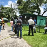
NCML/RSI will be on island partnering with the critical stakeholders primarily the Divisions of Agriculture, Forestry, Dominica State College and others during its forty-five (45) day exercise.
The purpose of the soil mapping project is to collect various soil samples across Dominica which will allow for the development of predictive models on soil properties across the island. From these models, land use interpretations for each landscape can be determined to provide a baseline for evaluating the impacts of management practices across various sectors such as agriculture, land use planning, engineering, forestry, water resource management, among others.
The soil mapping project is being implemented under the Disaster Vulnerability Reduction Project (DVRP) through grant funding from the World Bank and will be executed and completed by October 2023.
The DVRP seeks the cooperation and understanding of the public and private landowners in grantingaccess to the team members and its partners to lands, and to facilitate the extraction of small samples of soils.
This is an opportune time to undertake an exercise to better inform us of our soil properties.
Let’s all play our part in building a resilient Dominica!


